![](/images/other/stat-length.png)
![Randonnée Attelage Le Controis-en-Sologne - evasion 2019 faite - Photo](https://media.geolcdn.com/t/1900/400/1e8dc8bc-d6b4-4894-9578-2c27d78e3d73.jpg&format=pjpeg&maxdim=2)
evasion 2019 faite
attelageplaisir
Utilisateur
![Longueur](/images/other/stat-length.png)
Longueur
44 km
![Altitude max](https://static1.geolcdn.com/siteimages/upload/files/1508320355ic_sort_altitude_max_24dp.png)
Altitude max
133 m
![Dénivelé positif](https://static1.geolcdn.com/siteimages/upload/files/1508320355ic_sort_den_pos_24dp.png)
Dénivelé positif
371 m
![Km-Effort](/images/other/stat-length.png)
Km-Effort
49 km
![Altitude min](https://static1.geolcdn.com/siteimages/upload/files/1508320355ic_sort_altitude_min_24dp.png)
Altitude min
87 m
![Dénivelé négatif](https://static1.geolcdn.com/siteimages/upload/files/1508320355ic_sort_den_neg_24dp.png)
Dénivelé négatif
371 m
![Boucle](https://static1.geolcdn.com/siteimages/upload/files/16400158638029165_repeat_loop_refresh_sync_direction_icon.png)
Boucle
Non
Date de création :
2019-07-27 07:40:23.356
Dernière modification :
2019-08-01 05:03:30.543
![Attelage](https://static1.geolcdn.com/sitytour/trail-icons/302.png)
8h56
Difficulté : Très facile
![Scannez ce code QR pour ouvrir la randonnée dans l'application SityTrail](https://capi.geolives.com/qq0zvz2zws4bq2lad0pu/sitytour/trails/2155973/qr.png?size=200)
Application GPS de randonnée GRATUITE
À propos
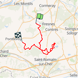
Randonnée Attelage de 44 km à découvrir à Centre-Val de Loire, Loir-et-Cher, Le Controis-en-Sologne. Cette randonnée est proposée par attelageplaisir.
Description
3 grilles à gibier à passer 1petit gue
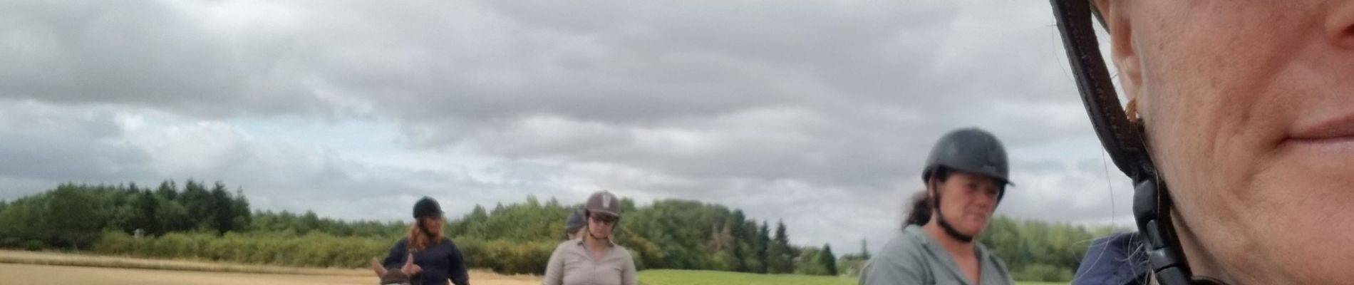
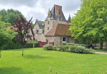
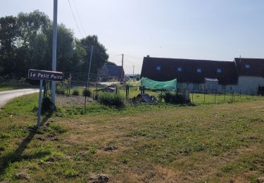
Localisation
Pays :
France
Région :
Centre-Val de Loire
Département/Province :
Loir-et-Cher
Commune :
Le Controis-en-Sologne
Localité :
Unknown
Départ:(Dec)
Départ:(UTM)
375951 ; 5254894 (31T) N.
Commentaires
Randonnées à proximité
![Randonnée Marche Le Controis-en-Sologne - fougeres sur bièvre GS 05 2024 - Photo](https://media.geolcdn.com/t/375/260/05521983-9667-44ed-b26e-5da0ef29486a.jpg&format=jpg&maxdim=2)
![Marche Marche](https://static1.geolcdn.com/sitytour/trail-icons/101.png)
fougeres sur bièvre GS 05 2024
Marche
Facile
Le Controis-en-Sologne,
Centre-Val de Loire,
Loir-et-Cher,
France
![](/images/other/stat-length.png)
13,8 km | 15,6 km-effort
3h 0min
![](https://static1.geolcdn.com/siteimages/upload/files/16400158638029165_repeat_loop_refresh_sync_direction_icon.png)
Oui
![Randonnée Marche Le Controis-en-Sologne - Feings 14.3 28 02 - Photo](https://media.geolcdn.com/t/375/260/ext.jpg?maxdim=2&url=https%3A%2F%2Fstatic1.geolcdn.com%2Fsiteimages%2Fupload%2Ffiles%2F1553511878bg_sport_marche.png)
![Marche Marche](https://static1.geolcdn.com/sitytour/trail-icons/101.png)
Feings 14.3 28 02
Marche
Facile
(1)
Le Controis-en-Sologne,
Centre-Val de Loire,
Loir-et-Cher,
France
![](/images/other/stat-length.png)
14,3 km | 15,8 km-effort
3h 30min
![](https://static1.geolcdn.com/siteimages/upload/files/16400158638029165_repeat_loop_refresh_sync_direction_icon.png)
Oui
![Randonnée Marche Le Controis-en-Sologne - BBR 2024-03-27 Ouchamps 15 km - Photo](https://media.geolcdn.com/t/375/260/feb1ebb1-765f-4bed-98d5-c72d6d0beadd.jpg&format=jpg&maxdim=2)
![Marche Marche](https://static1.geolcdn.com/sitytour/trail-icons/101.png)
BBR 2024-03-27 Ouchamps 15 km
Marche
Moyen
Le Controis-en-Sologne,
Centre-Val de Loire,
Loir-et-Cher,
France
![](/images/other/stat-length.png)
14,7 km | 16,3 km-effort
1h 14min
![](https://static1.geolcdn.com/siteimages/upload/files/16400158638029165_repeat_loop_refresh_sync_direction_icon.png)
Oui
![Randonnée Vélo de route Sambin - fougères sur biévres - Photo](https://media.geolcdn.com/t/375/260/5f05a9e2-77a8-4c2f-888a-bddd155c8370.jpg&format=jpg&maxdim=2)
![Vélo de route Vélo de route](https://static1.geolcdn.com/sitytour/trail-icons/201.png)
fougères sur biévres
Vélo de route
Facile
Sambin,
Centre-Val de Loire,
Loir-et-Cher,
France
![](/images/other/stat-length.png)
10,7 km | 11,7 km-effort
2h 34min
![](https://static1.geolcdn.com/siteimages/upload/files/16400158638029165_repeat_loop_refresh_sync_direction_icon.png)
Oui
![Randonnée Vélo de route Sambin - la croix des bordes - Photo](https://media.geolcdn.com/t/375/260/2bc8fc9c-e97d-4b60-bd23-266aaa7b3807.jpg&format=jpg&maxdim=2)
![Vélo de route Vélo de route](https://static1.geolcdn.com/sitytour/trail-icons/201.png)
la croix des bordes
Vélo de route
Facile
Sambin,
Centre-Val de Loire,
Loir-et-Cher,
France
![](/images/other/stat-length.png)
13,4 km | 14,4 km-effort
1h 9min
![](https://static1.geolcdn.com/siteimages/upload/files/16400158638029165_repeat_loop_refresh_sync_direction_icon.png)
Oui
![Randonnée sport Le Controis-en-Sologne - Rando Betty Feings - Photo](https://media.geolcdn.com/t/375/260/12743490-0231-4110-8dbe-1e9612e6aa28.jpg&format=jpg&maxdim=2)
Rando Betty Feings
sport
Très facile
Le Controis-en-Sologne,
Centre-Val de Loire,
Loir-et-Cher,
France
![](/images/other/stat-length.png)
54 km | 59 km-effort
Inconnu
![](https://static1.geolcdn.com/siteimages/upload/files/16400158638029165_repeat_loop_refresh_sync_direction_icon.png)
Non
![Randonnée A pied Le Controis-en-Sologne - fougeres sur bievre GS petit 2 05 2024 - Photo](https://media.geolcdn.com/t/375/260/ext.jpg?maxdim=2&url=https%3A%2F%2Fstatic1.geolcdn.com%2Fsiteimages%2Fupload%2Ffiles%2F1545311037marcheuse_200dpi.jpg)
![A pied A pied](https://static1.geolcdn.com/sitytour/trail-icons/100.png)
fougeres sur bievre GS petit 2 05 2024
A pied
Facile
Le Controis-en-Sologne,
Centre-Val de Loire,
Loir-et-Cher,
France
![](/images/other/stat-length.png)
10,9 km | 12,3 km-effort
2h 47min
![](https://static1.geolcdn.com/siteimages/upload/files/16400158638029165_repeat_loop_refresh_sync_direction_icon.png)
Oui
![Randonnée A pied Le Controis-en-Sologne - fougeres sur bievre GS petit 05 2024 - Photo](https://media.geolcdn.com/t/375/260/ext.jpg?maxdim=2&url=https%3A%2F%2Fstatic1.geolcdn.com%2Fsiteimages%2Fupload%2Ffiles%2F1545311037marcheuse_200dpi.jpg)
![A pied A pied](https://static1.geolcdn.com/sitytour/trail-icons/100.png)
fougeres sur bievre GS petit 05 2024
A pied
Facile
Le Controis-en-Sologne,
Centre-Val de Loire,
Loir-et-Cher,
France
![](/images/other/stat-length.png)
11,4 km | 12,7 km-effort
2h 53min
![](https://static1.geolcdn.com/siteimages/upload/files/16400158638029165_repeat_loop_refresh_sync_direction_icon.png)
Oui
![Randonnée Marche Le Controis-en-Sologne - Babeth - Photo](https://media.geolcdn.com/t/375/260/ext.jpg?maxdim=2&url=https%3A%2F%2Fstatic1.geolcdn.com%2Fsiteimages%2Fupload%2Ffiles%2F1553511878bg_sport_marche.png)
![Marche Marche](https://static1.geolcdn.com/sitytour/trail-icons/101.png)
Babeth
Marche
Très facile
Le Controis-en-Sologne,
Centre-Val de Loire,
Loir-et-Cher,
France
![](/images/other/stat-length.png)
5,8 km | 6,7 km-effort
36h 23min
![](https://static1.geolcdn.com/siteimages/upload/files/16400158638029165_repeat_loop_refresh_sync_direction_icon.png)
Non